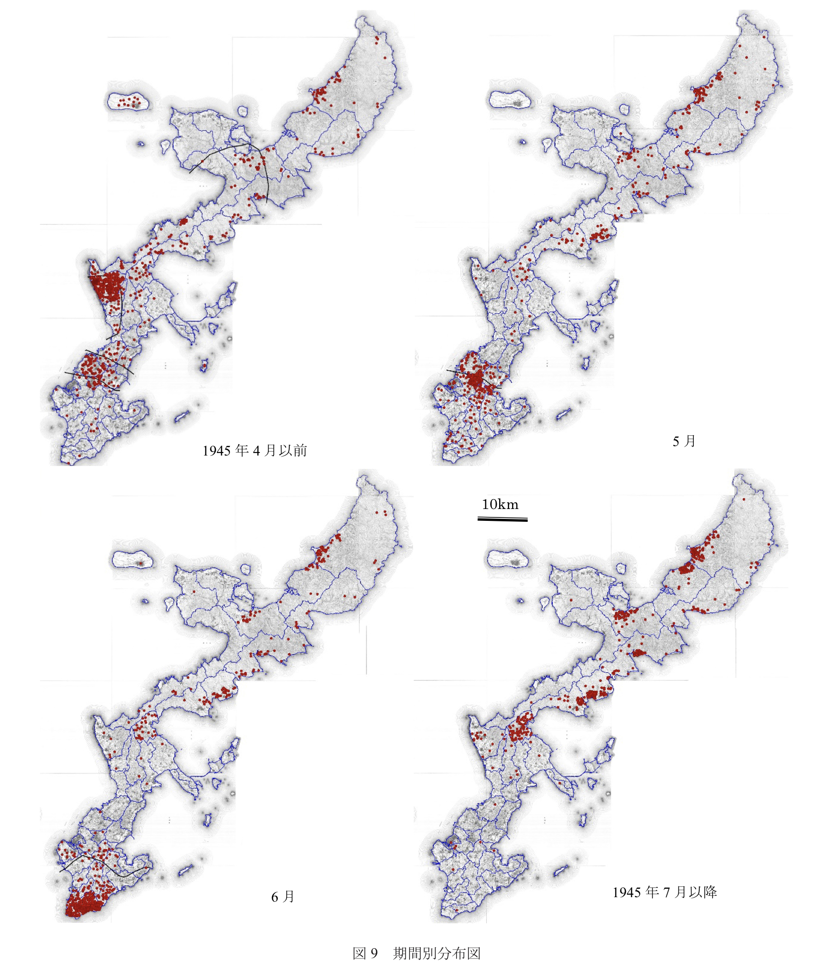
Abstract: This paper aimed to visualize the spatial distribution based on the location names listed in the Yomitan Village roster of the deceased, elucidating the patterns of distribution. By creating thematic maps according to the period and the distinction between combatants and non-combatants, it was possible to illustrate the changing distribution patterns in accordance with the progression of the Battle of Okinawa, alongside the characteristics of distribution based on gender and age. Moreover, through a comparative analysis between the data of Gushikawa Village and Yomitan Village, it became evident that the difference in the distribution, especially among non-combatants, was substantial. This variance was assumed to be primarily due to the geographical locations of Yomitan Village, where the US forces initially landed in the central part of Okinawa Island, and Gushikawa Village, which was involved in combat towards the end, situated in the southernmost part of the island. (ChatGPT)
Abstract: The spatial distribution of the Yomitan War Cemetery War Veterans List was visualized by reconstructing the locations of the deaths from the place names. From the data, thematic maps were created according to the time period and the participation/non-participation groups, and the changes in distribution with the progress of the Battle of Okinawa and the characteristics of distribution according to gender and age groups were clarified. Comparison of the data for Gushigami and Yomitan villages revealed that the differences in distribution were particularly large among the non-participants. This difference is thought to be due to the geographical location of Yomitan Village, where the U.S. forces first landed in the center of Okinawa Island, and Gushigashira Village, which was the last village to be involved in the battle at the southern tip of Okinawa Island. (DeepL)

コメント