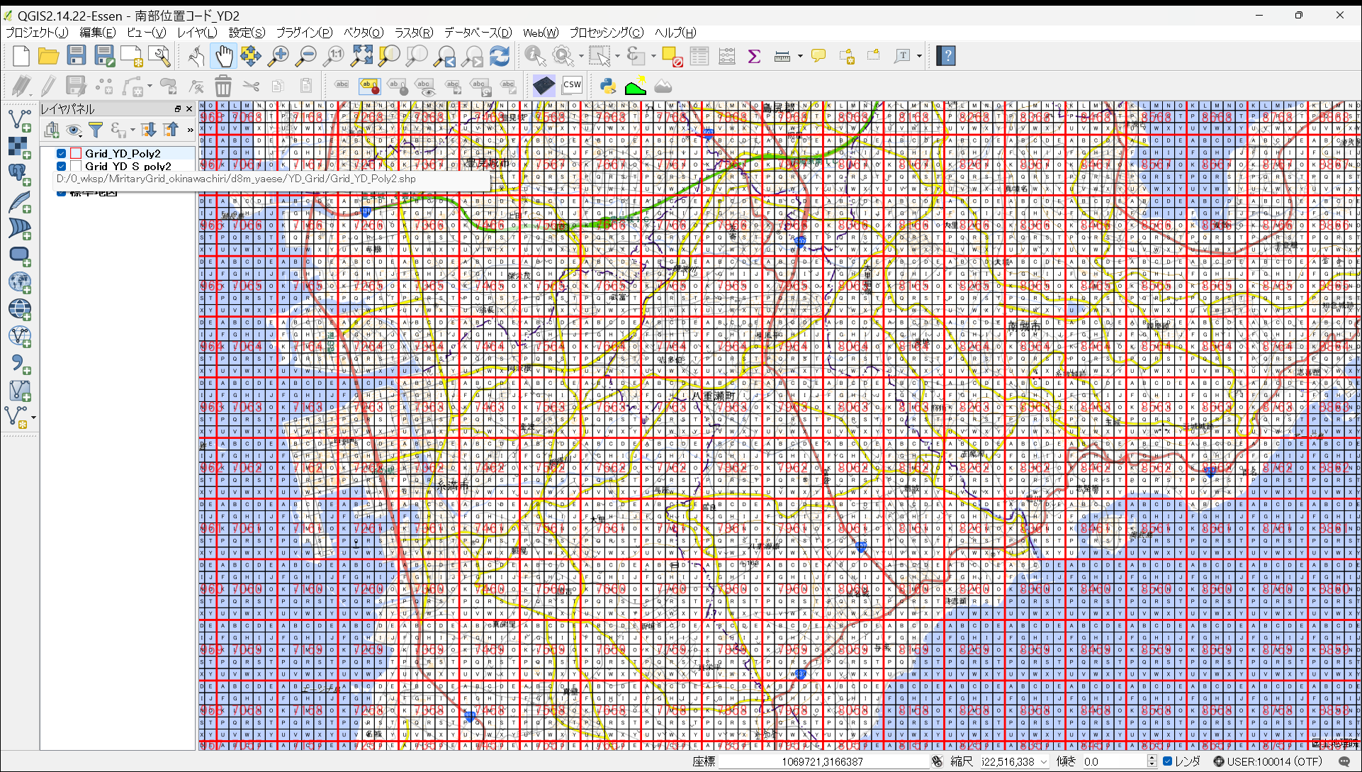
Abstract: In the U.S. military operational reports during the Battle of Okinawa in 1945, location information, such as attack points and combat areas, were represented by a combination of four-digit numbers and a single alphabet—a coordinate code. To interpret the U.S. military records of the Okinawa battle, access to the “L-891 series,” strategic maps created by the U.S. Army Corps of Engineers at a 1:25,000 scale with these coordinate codes, becomes imperative. However, obtaining these maps is challenging, and processing extensive data solely based on them is difficult. Therefore, considering the potential of Geographic Information System (GIS), this study aimed to reconstruct the grid method using GIS, making it possible to use the coordinate-coded grid as GIS vector data with attribute information. Referencing prior research available on the web, this study estimated the projection method and coordinate system of the aforementioned topographic maps. It successfully reconstructed 1000-yard and 200-yard grids as GIS data. Utilizing this GIS data enables the spatial organization of the situations documented in U.S. military operational reports. Additionally, by incorporating historical topographic maps, aerial photographs from that era, and current topographic maps as background data, and integrating attribute information from the U.S. military operational reports, various thematic maps can be created, facilitating a wide array of spatial analyses. (ChatGPT)
Abstract: In the U.S. military operation reports for the Battle of Okinawa in 1945, location information such as attack points and battle sites are indicated by coordinate codes consisting of a four-digit number and a single letter of the alphabet. Therefore, in order to decipher the U.S. military records of the Battle of Okinawa, the “L-891 series” of 1:25,000 strategic maps created by the U.S. Army Corps of Engineers in the Pacific theater and illustrating their coordinate codes are required. However, those maps are difficult to obtain, and it is difficult to process a large number of data without them. Therefore, we thought that if the grid generation method could be restored in a GIS, the grid with coordinate codes as attribute information could be used as GIS vector data. In this study, we estimated the projection method and coordinate system of the above topographic maps by referring to previous studies on the web, and succeeded in restoring the 1000-yard grid and 200-yard grid as GIS data. By using this GIS data, the situation described in the U.S. military operation report can be maintained as spatial information. In addition, by replacing topographic maps of the time, aerial photographs, and current topographic maps as background maps, and by creating various thematic maps based on the conditions in the U.S. military operation reports imported as attribute information, many types of spatial analysis can be performed. (DeepL)
コメント