 琉球列島地形復元
 Topographic Analysis of the Fukuji Riversystem
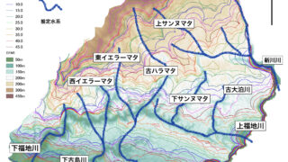
Abstract: Peak-to-saddle maps are considered as representations of the pre-eroded topography, and by expanding the buffer size, these maps are used to estimate ...
琉球列島地形復元 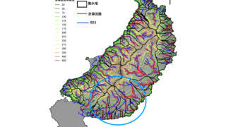 琉球列島地形復元
  琉球列島地形復元
  琉球列島地形復元
 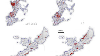 沖縄戦
沖縄戦 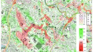 琉球列島地形復元
 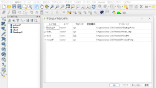 QGIS
QGIS