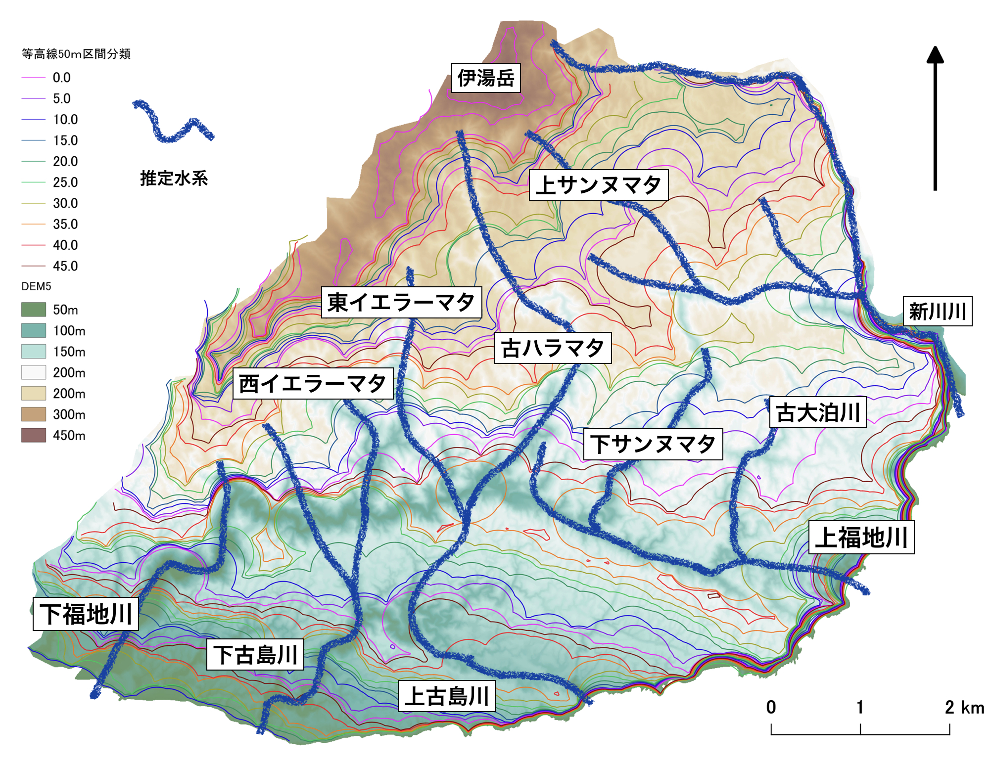
Abstract: Peak-to-saddle maps are considered as representations of the pre-eroded topography, and by expanding the buffer size, these maps are used to estimate earlier landscapes, thereby constructing the history of water system changes in the Fukuchi River basin and its surrounding areas. Utilizing the generated grid elevation data in hydrological and terrain analysis, this study examined the reinforcement of the water system’s historical changes and considered potential causes for these variations. Conclusions drawn included the assessment that the upper Fukuchi River segment along the Ginan-saki Northern Fault had flowed eastward in the past.
In the examination of the water system’s historical changes, due to the relative timeframe denoted as the buffer period, the average displacement velocity of active faults couldn’t be incorporated into the peak-to-saddle analysis. The Fukuchi Dam, the largest dam in Okinawa Prefecture, harnesses a water system developed due to active fault movements, enabling efficient water storage. To evaluate the impact of fault activity, a detailed examination of the characteristics of these fault groups is essential.
In order to assess the effects of fault activity, a thorough investigation into the nature of these fault groups is necessary. (chatGPT)
Abstract: The tangent surface is considered to be a reconstruction of the pre-erosion topography of the field profile, and the past topography is further estimated by enlarging the buffer size to construct the hydrogeological history of the Fukuchi River basin and its vicinity. The results of hydrological and geomorphological analysis of the grid elevation data were used to reinforce the hydrological history of the river system and to examine the causes of the changes in the river system. In these studies on the history of water system transitions, the average displacement velocity of the active fault could not be incorporated into the tangent surface analysis because of the relative time axis of the Buffer Period. The Fukuchi Dam is the largest dam in Okinawa Prefecture that can be efficiently flooded by utilizing the water system developed by active faulting. In order to examine the effects of faulting activity, a close examination of the nature of these fault groups is necessary. (DeepL)

コメント