Abstract: This research developed a method using GIS software to create peak-to-saddle maps and saddle maps via the buried valley method from digital contour data. This technique allows for the generation of multiple analytical maps by modifying creation conditions such as the extent of analysis and burial distance of valleys. Furthermore, the peak-to-saddle maps are produced as digital data, enabling the extraction of various numerical terrain analysis results from this base.
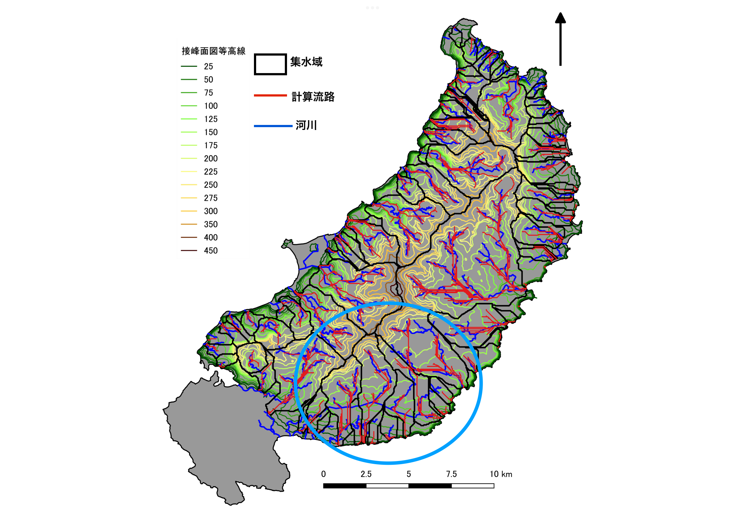
As an application example, terrain analysis maps, including peak-to-saddle maps, saddle maps, and relief maps, were generated for the region from Shioya to north of Taira in northern Okinawa Island. This facilitated an exploration of the region’s topographical characteristics and developmental processes. Detailed analyses utilizing topographical metrics for mountainous areas, hills, and water systems were conducted compared to previous studies.
This study revealed a high potential for displacement in hills and plateaus due to active faults in the Fukuchi River basin and the surrounding hills. The associated potential alterations in river channels due to these displacements were also identified. (chatGPT)
Abstract: A method was developed for creating tangent and tangent valley surface maps from digital contour data using GIS software based on the buried valley method. This method enables the creation of multiple analysis maps by changing creation conditions such as wide-area analysis and valley-filling distance. In addition, since the tangent surface maps are generated as digital data, various numerical topographic analysis results can be obtained based on the digital data. As an example of the application of these methods, topographic analysis maps such as buried valley tangent surface maps, tangent valley surface maps, and undulation maps were created for the Shioya-Hirara and northern Okinawa Island, and the topographic features and development process of this area were discussed. Compared with previous studies, this study provides a detailed discussion of mountainous areas, hills, water systems, etc., using topographic measurements. This study indicates that there is a high possibility of displacement of hills and plateaus by active faults in the Fukuchi River basin and surrounding hills, and changes in river flow paths due to such displacement. (DeepL)

コメント